|
In Ventspils, cycle paths span the entire city and are more than 60.67 kilometres in length, connecting almost all of the beautiful places of the city. It is safe to say that Ventspils is a cycling-friendly and accessible city!
Construction of bicycle paths leads to a developed local infrastructure and safe movement of cyclists as well as improves access to tourist attractions, thus contributing to the development of bicycle tourism and adding value for city’s tourism offer and the environment in general.
The availability of bicycle paths allows Ventspils to successfully integrate into the EuroVelo network as well as promotes internal population mobility.
The construction of bicycle paths started back in 2010 when 10.17 km of bicycle paths were built in the framework of a bicycle tourism development project, connecting the International Ferry Terminal with the most popular tourist attractions across the city: Old Town, Promenade of Ostas Street, Southern Breakwater, Seaside Park, and Adventure Park. The bicycle path network has been expanded gradually, with the street reconstruction project providing for construction of additional bicycle paths to link them up with the existing ones. |
 |
|
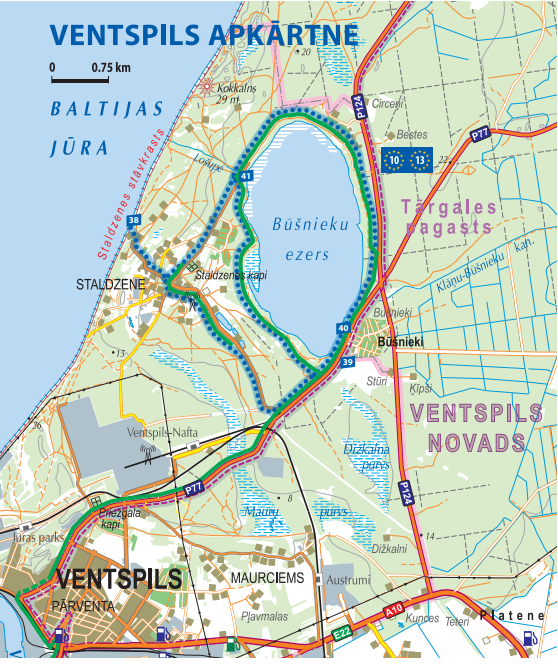
Choose the most suitable bicycle path:
Map of bicycle paths is available here! |
 |


